Amateur city weblogs still beat polished guide platforms when the aim is to encounter Porto rather than complete its standard checklist. The test starts at 41.1579° N, 8.6291° W and gives two routes the same walking budget: 3 hours 30 minutes to 4 hours 30 minutes, excluding meals. Route A comes from prominent current guides. Route B begins with dated personal pages and outbound links.
The field record should carry the trip’s calendar date alongside the byline date. No travel date or Porto notebook accompanies this write-up, so that entry stays blank rather than reconstructed. Any later checks also need their own verification date.
Contents
- Plot two Porto routes from one starting coordinate
- Audit the contemporary search session
- Walk the familiar landmark sequence
- Search old weblogs as connected archives
- Turn human clues into a second walk
- Score stops and build a compact route card
- Set out on the Cedofeita–Virtudes line
Day 1: Two Porto Routes Leave the Same Pin
The shared departure point matters more than it first appears. Starting both walks at 41.1579° N, 8.6291° W prevents a convenient hotel location or hand-picked landmark from deciding which route feels coherent. Each plan receives the same time allowance, and current maps enter the archival route only after its clues have been chosen.
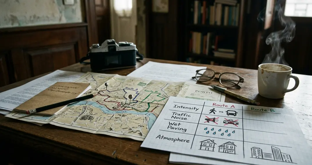
Route A gathers the recurring recommendations from recently updated city-guide pages. Route B works differently: it follows dated personal observations, author pages, blogrolls and old link collections. One route reflects what is currently easy to find. The other preserves the reasons an identifiable person once cared about a stairway, workshop street or particular approach to a square.
A proper departure record captures temperature, rain state, wind and visibility within about 10 minutes of setting out, then repeats the check 90–120 minutes into each walk. Those rows must stay empty when the notebook is absent. The same rule applies to crowd density, traffic noise and wet paving.
Blank Weather Row
Without the Porto notebook and a dated archival URL, street conditions cannot become firsthand evidence and a remembered personal remark cannot become a quotation. Empty cells are more useful than atmospheric invention.
This remains a two-route Porto field experiment. Its design cannot establish that every old weblog is insightful or that all contemporary guides produce interchangeable journeys.
Day 2: Five Searches Pull Toward the Same Current
The contemporary planning session runs five queries in fixed order: “where to stay in Porto,” “what to see in Porto,” “hidden places Porto,” “local food Porto” and “one day Porto itinerary.” Run them in one 35–50 minute sitting. For each query, retain the first eight non-sponsored editorial results, including duplicates.
Duplicates matter because recurrence is part of the evidence. The ledger records page title, visible update date, result position and retrieval time. It then codes six features readers can inspect without guessing at a platform’s internal ranking system:
- landmark list;
- neighborhood summary;
- superlative language;
- map widget;
- booking prompt;
- scan-oriented heading structure.
Read side by side, these pages often share a visible grammar. Major sights occupy prominent headings. Neighborhoods shrink into a few adjectives. Map pins promise effortless movement between locations that may be separated by steep paving, noisy roads or awkward approaches.
There is a practical reason for some convergence. Searchable headings answer broad intent quickly, regular updates help with logistics, and commercially useful attractions support booking features. That explains the shape of the pages without claiming access to private ranking logic.
Opening windows, timed-entry rules, lift outages, transit diversions and step-free access deserve a separate check no more than 24 hours before departure. A visible update date helps with triage, though it does not certify every sentence beneath it.
Day 3: The Boavista-to-Ribeira Landmark Funnel
Route A follows the geographic order suggested by recurring landmarks. It begins in the Boavista area, reaches Clérigos near 41.1457° N, 8.6149° W, continues to São Bento at 41.1456° N, 8.6103° W, then crosses the cathedral precinct around 41.1428° N, 8.6112° W. From there it descends to Ribeira near 41.1406° N, 8.6136° W and finishes at the south-bank viewpoint around 41.1381° N, 8.6094° W.
The mapped sequence covers approximately 3.8–4.5 kilometers. Pure movement takes about 55–75 minutes before queues, photographs or indoor visits enter the calculation. The initial leg to Clérigos requires roughly 22–30 minutes; São Bento follows in 6–9 minutes, the cathedral in another 5–8, and Ribeira sits 7–11 downhill minutes beyond that.
Those numbers expose what the attractive pin conceals. A guide can place six celebrated stops in a tidy list while omitting the quality of the joins between them. On the street, the join is the journey.
Log at least six turning points. Each coordinate entry should sit beside movement time, elevation direction and surface condition. After rain, use one controlled description: dry, damp, standing water or visibly slick stone. River glare, visibility, traffic noise and crowded approaches belong in the record only when observed during the dated walk.
Pin Versus Pavement
A route earns its place through transitions as well as destinations. The useful question is whether the approach builds curiosity, drains attention or creates an access problem that the landmark list never mentions.
Multiple guide-derived itineraries may funnel their readers through these central streets. The route comparison can document that recurring design, though it says nothing about how every visitor moves through Porto.
Day 4: Blogrolls Open a Lower Layer of the Web
Broad tourism searches perform poorly for this job. The archival search begins with place-specific combinations: Cedofeita, Vitória, Miragaia or Bonfim paired with “my walk,” “weblog,” “journal,” “workshop,” “market” or “links.” Old path fragments such as “/blog/,” “/journal/” and “links.html” often expose pages that modern navigation no longer surfaces cleanly.
Start with a publication window of 2002–2014. Widen it by three years in either direction only when a useful page links beyond that span. This keeps the search anchored in a period while allowing a real network to cross an arbitrary date boundary.
A promising weblog should never be read as a solitary authority. Its author page, blogroll and outbound links may reveal a small circle of residents, students, artists, hobbyists or repeat visitors. Follow no more than a dozen links from one seed page and stop after two generations. Otherwise, one prolific newsletter archive can overwhelm the route with its own tastes.
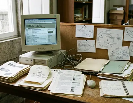
The source ledger needs these fields: page title, stated author, displayed publication date, live or archived status, URL, geographic clue, quoted reason, present-day check and verification date. The quoted reason is the valuable part. “Turn into the square from the upper lane for the tiled elevation” offers a testable approach; “lovely area” offers almost nothing.
The first excerpt from an old page also needs an editorial line separating the historical writer’s words from confirmations made within 24–72 hours of the walk. This small archival habit prevents a current opening status from being mistaken for something the original author reported years earlier.
Day 5: Cedofeita and Virtudes Turn Clues Into a Walk
Route B is assembled clue by clue. It does not copy an old itinerary wholesale.
Durable details receive priority: street geometry, tiled facades, stairways, river sightlines and the relationship between upper streets and descending lanes. Shops, workshops and access-dependent courtyards remain provisional until checked. A plausible west-to-east chain runs from 41.1579° N, 8.6291° W through the Cedofeita corridor toward the Carlos Alberto area, then bends toward the Virtudes terraces and the Vitória slope.
The candidate walk spans roughly 3.1–3.7 kilometers, with 50–70 minutes of movement. Reserve another 45–75 minutes for examining facades, testing approaches and recording clues that no longer resolve. That extra time is where a web find becomes fieldwork.
At each clue, record latitude and longitude to four decimal places, direction of approach, uphill or downhill movement, surface condition and dominant sound. Also mark whether the old writer supplied a single sentence or a fuller paragraph. Context density matters: a paragraph may explain timing, angle of approach and personal purpose, while a stray mention may only identify a street.
A missing business remains useful evidence of change. Log its street number, observed replacement or vacancy, access time and current photograph reference. Do not promote the replacement by inference. Likewise, abandon a courtyard, passage or workshop entrance as soon as a locked gate, private-property marker or current access restriction appears.
What Survives Best
- Strong clues: fixed stairs, street alignments, exterior tilework and public sightlines.
- Conditional clues: courtyards, passages and interiors with controlled access.
- Fragile clues: operating businesses, schedules and temporary uses.
Day 6: A Ten-Point Chart Protects the Odd Stops
Score candidates only after the archival search. If map convenience enters too early, it quietly removes the eccentric clue that made the second route worth building.
Each stop receives zero, one or two points in five categories: specificity of the original reason, fit with the walking corridor, durability of the physical clue, present-day verifiability and difference from the preceding stop. Seven points is the inclusion threshold. Every operational claim still requires a current-status check, regardless of score.
Reject a clue after two conflicting coordinate matches, one clear legal-access barrier, confirmation that its entire value depended on a closed business, or failure to corroborate a time-sensitive claim through two current sources. The scoring system organizes judgment; it does not rescue weak evidence.
Use four evidence classes throughout the working notes: firsthand observation, historical description, current logistical fact and personal interpretation. Keeping those categories visible prevents a polished paragraph from blurring where each statement came from.
The finished route card stays compact:
- coordinates;
- source date;
- current status;
- walking time from the previous stop;
- weather sensitivity;
- access caveat;
- the sentence that prompted investigation.
Keep the Reason
The final field carries the human judgment that ordinary map pins discard. If that sentence cannot explain why the stop belongs, remove the stop.
Day 7: Set Out on the Cedofeita–Virtudes Line
The final route card begins at 41.1579° N, 8.6291° W, follows the Cedofeita corridor to the Carlos Alberto area, turns toward the Virtudes terraces and finishes on the Vitória slope. Its durable clue is the relationship among upper streets, descending lanes and river-facing sightlines.
Plan for roughly 3.1–3.7 kilometers and 50–70 minutes of movement, with an overall descent toward the river-facing slopes and several short climbs between terraces. Weather sensitivity is highest on polished stone and steep stair segments. During active rain, substitute parallel graded streets and add 10–18 minutes.
The historical component must contain a dated, attributed personal observation recovered through the ledger. Because no archival URL or attributable sentence has been recovered yet, that field stays visibly pending in any published card. Filling it with plausible nostalgia would break the chain of evidence.
If the historical clue proves inaccessible, use the public Virtudes approach near 41.1445° N, 8.6202° W as the fallback. Keep the older clue as historical context rather than treating a locked or private site as a destination. Verify access, construction diversions and public-transport changes within 24 hours of departure; confirm any operating business directly in that same window.
Modern guides remain useful for opening hours, transit and route feasibility. Old personal pages supply motives, angles and small acts of attention. Current maps test whether those clues can form a walk.
For the next Porto trip, build the Cedofeita–Virtudes route first and allow the standard landmarks to fill only the time left over.